

Unveiling the Ocean’s Secrets: Exploring the Role of Multibeam Sonar in Oceanfloor Mapping
The ocean floor, a vast and mysterious expanse, has long been a subject of intrigue and exploration. Therefore, with recent advancements in technology, especially multibeam sonar, our ability to map these underwater landscapes has indeed reached unprecedented levels. This powerful tool is transforming how we understand the ocean’s hidden depths by providing high-resolution images and detailed data. In this post, we will delve into the fascinating world of multibeam sonar and its role in oceanfloor mapping, highlighting the collaborative efforts of software and hardware engineers in its development. So, join us as we explore the revolutionary impact this technology is having on our comprehension of the Earth’s final frontier. To learn more about multibeam sonar technology, please visit NOAA’s Ocean Exploration Tools.
Revolutionizing Oceanfloor Mapping
So, the advent of multibeam sonar technology has ushered in a new era of oceanfloor mapping, providing unprecedented detail and coverage. Therefore, this section explores the fundamentals of multibeam sonar and the current state of our ocean mapping efforts.
Introduction to Multibeam Sonar
Multibeam sonar is a groundbreaking technology that has transformed our ability to map the ocean floor. This advanced system uses sound waves to create detailed 3D images of underwater terrain.
Unlike traditional single-beam sonar, multibeam systems emit multiple sound beams in a fan-like pattern. This allows for wider coverage and thus more precise depth measurements.
For this reason, the technology works by sending out sound pulses and measuring the time it takes for the echoes to return. Then, sophisticated software processes this data to create highly accurate bathymetric maps.
Multibeam sonar has numerous uses, from navigation and offshore resource exploration to marine habitat mapping and underwater archaeology.
Current Mapping Coverage
Despite significant advancements in oceanfloor mapping technology, our knowledge of the ocean floor remains surprisingly limited. Current estimates suggest that only a small portion of the ocean floor has been mapped in high detail.
According to the National Academy of Engineering, approximately 15% of the ocean floor has been mapped using modern methods as of 2021. Meanwhile, this leaves vast areas of the ocean unexplored and unmapped.
Furthermore, the Seabed 2030 project, a collaborative initiative, aims to map the entire ocean floor by 2030. This ambitious goal highlights the importance of continued technological development and international cooperation.
Moreover, efforts to increase mapping coverage face challenges such as the sheer size of the ocean, the extreme depths involved, and the high cost of deep-sea exploration.
Engineers Behind the Technology
The development and implementation of multibeam sonar technology rely on the expertise of various engineering fields. Thus, this section highlights the diverse types of engineers involved and their crucial contributions to oceanfloor mapping.
Types of Engineers Involved
The creation and operation of multibeam sonar systems involve a diverse team of engineers, each bringing unique skills to the table. As a result, these professionals work collaboratively to push the boundaries of ocean exploration.
Firstly, acoustic engineers play a crucial role in designing and optimizing the sonar systems. They focus on the generation, transmission, and reception of sound waves underwater.
Meanwhile, software engineers develop sophisticated algorithms to process the vast amounts of data collected by multibeam sonar. They also create user-friendly interfaces for data visualization and analysis.
Electrical engineers, on the other hand, work on the hardware components of the sonar systems, ensuring reliable power supply and signal processing. Additionally, they contribute to the development of advanced sensors.
Finally, mechanical engineers design the physical structures that house the sonar equipment, considering factors such as pressure resistance and hydrodynamics for underwater vehicles.
Contributions to Oceanfloor Mapping
So, engineers have made significant contributions to oceanfloor mapping, revolutionizing our understanding of the underwater world. Their innovations have led to more accurate, efficient, and comprehensive mapping techniques.
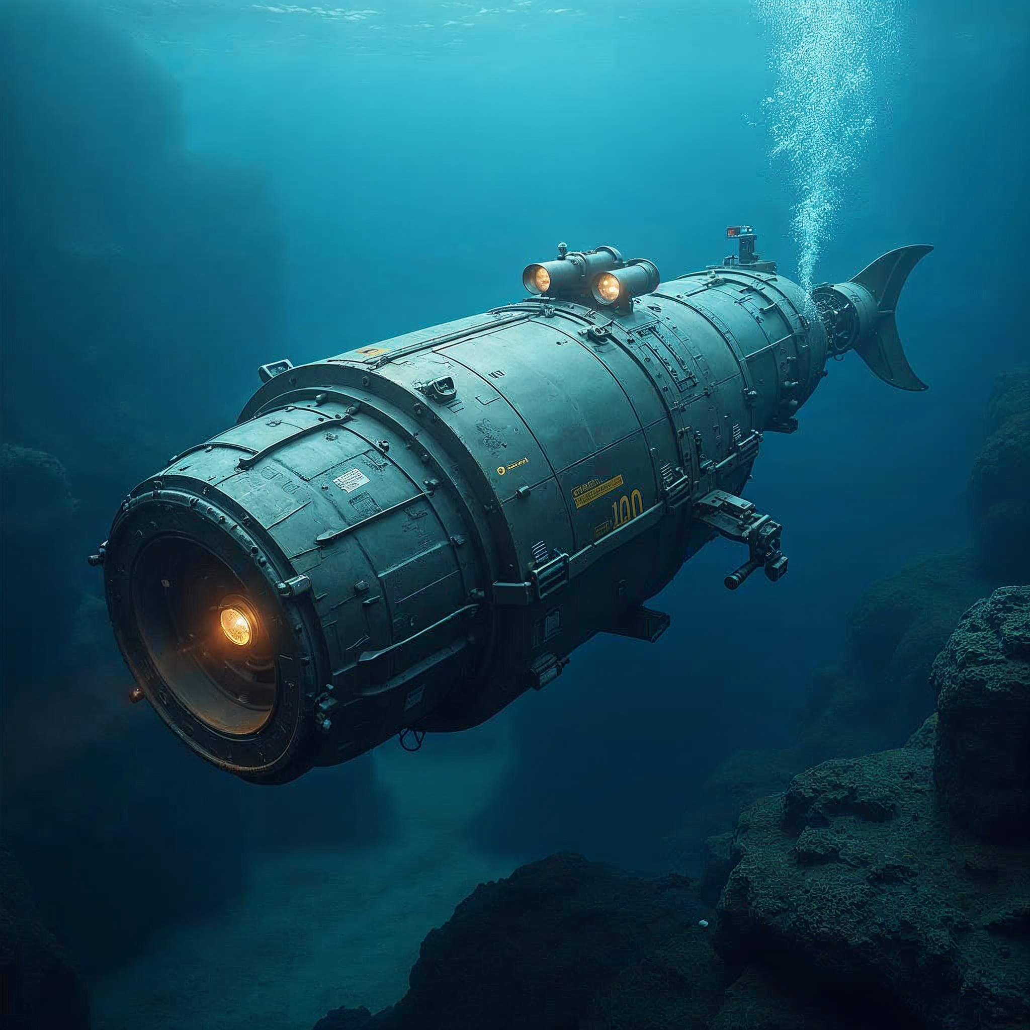
Therefore, one major contribution is the development of autonomous underwater vehicles (AUVs) equipped with multibeam sonar. These robots can operate in extreme depths and challenging environments, collecting data in areas previously inaccessible to humans.
Moreover, engineers have also improved data processing capabilities, allowing for real-time 3D visualization of the ocean floor. This advancement enables more efficient survey planning and immediate identification of areas of interest.
In addition, the integration of GPS and inertial navigation systems has greatly enhanced the accuracy of oceanfloor maps. Engineers have developed sophisticated algorithms to correct for vessel motion and sound velocity variations in water.
Thus, collaborative efforts between engineers and marine scientists have led to the creation of standardized data formats and sharing platforms, thereby facilitating global oceanographic research and exploration.
As technology continues to advance, the future of oceanfloor exploration looks promising. Thus, this section examines upcoming developments in sonar technology and the potential discoveries and impacts they may bring.
Advancements in Sonar Technology
The field of sonar technology is rapidly evolving, with new innovations promising to enhance our ability to map and understand the ocean floor. Therefore, these advancements are set to revolutionize oceanfloor exploration.
One exciting development is the integration of artificial intelligence and machine learning into sonar systems. These technologies can help automate data processing, improve feature detection, and even predict underwater geological formations.
Meanwhile, airborne lidar bathymetry is another promising technology. By using aircraft-mounted lasers, it allows for rapid mapping of shallow coastal areas, complementing traditional ship-based sonar methods.
Moreover, improvements in power efficiency and miniaturization are making long-duration AUV missions more feasible. This could lead to more comprehensive mapping of remote ocean areas.
The development of higher frequency, broader bandwidth sonar systems promises to provide even more detailed images of the seafloor, potentially revealing features previously invisible to current technologies.
Potential Discoveries and Impacts
The continued advancement of oceanfloor mapping technology holds the promise of numerous discoveries and far-reaching impacts across various fields. Thus, these potential outcomes highlight the importance of ongoing research and development in this area.
In the realm of geology, improved mapping could lead to a better understanding of tectonic processes, underwater volcanoes, and mineral deposits. This knowledge could have implications for natural disaster prediction and resource exploration.
Marine biologists, in turn, may discover new species and ecosystems in previously unexplored areas of the ocean floor. This could contribute to biodiversity conservation efforts and potentially uncover new pharmaceutical compounds.
For climate science, detailed seafloor maps could improve our understanding of ocean currents and their role in global climate systems. This information is crucial for creating more accurate climate models.
Archeologists may uncover sunken cities, shipwrecks, and other historical artifacts, shedding light on human history and past civilizations. Therefore, the technology could also aid in locating and recovering valuable lost items.
Lastly, comprehensive ocean floor mapping is indeed essential for the responsible development of the “blue economy,” including offshore renewable energy, sustainable fisheries, and underwater communication networks.
BriTech Group, Inc.
None of these remarkable technological advancements would be possible without the expertise and dedication of engineers, developers, and scientists who create and innovate. At the forefront of connecting tech talent with opportunities to build the future is Britech Group. Our company specializes in matching skilled professionals with leading organizations, ensuring that groundbreaking projects have the right people behind them. We invite both hiring managers and candidates to explore the possibilities with us. Discover how we can bring your technical visions to life by visiting Britech Group. To explore more about our spotlights on pioneering technology and innovation, check out this article.